Explore
Featured
Recent
Articles
Topics
Login
Upload
Featured
Recent
Articles
Topics
Login
Upload
Search Results for 'grid area'
grid area published presentations and documents on DocSlides.
AREA & GRID REFERENCING
by ximena
SUCCESS CRITERIA. To be able to apply 4 & 6 fi...
Monitoring of the Power Grid State of the Art
by faustina-dinatale
Speaker: Yee Wei Law. Collaborators: . Umith. . ...
GIS in Water Resources Watershed and Stream Network Delineation
by cadie
CUAHSI Virtual University. David Tarboton. Utah St...
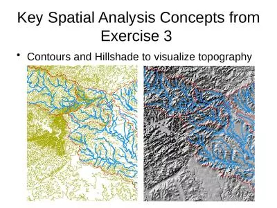
Key Spatial Analysis Concepts from Exercise 3
by susan2
Contours and Hillshade to visualize topography. Zo...
How Did Metro Boston Grow?
by cheryl-pisano
2000-2010. 11.521 – Spatial Database Management...
Opportunity based model component
by jane-oiler
of “. The . economic impact of penguin island c...
Opportunity based model component
by tatyana-admore
of “. The . economic impact of penguin island c...
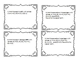
1) Find the area of
by conchita-marotz
1) Find the area of with vertices 2) Find th...
How Did Metro Boston Grow?
by tatyana-admore
2000-2010. 11.521 – Spatial Database Management...
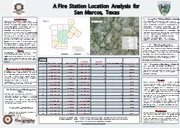
A Fire Station Location Analysis for
by phoebe-click
San Marcos, Texas. Introduction. The City of San...
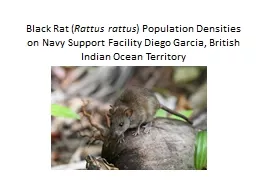
Black Rat (
by conchita-marotz
Rattus. . rattus. ) Population Densities on Navy...
The Ocean-Land-Atmosphere Model (OLAM)
by liane-varnes
Robert L. Walko. Roni Avissar. Rosenstiel School ...
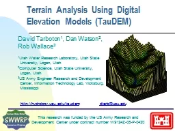
Terrain Analysis Using Digital Elevation Models (
by luanne-stotts
TauDEM. ). David Tarboton. 1. , Dan Watson. 2. , ...
Decimals and the Area Model
by pamella-moone
Decimals are fractions written in a different for...
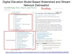
Digital Elevation Model Based Watershed and Stream Network
by olivia-moreira
Understanding. How to use. Reading. http://resour...
Developing Obstruction grids
by jane-oiler
Arun. . Chawla. The WAVEWATCH III Team + friends...
Where is Tornado Alley? AF1 - Drawing a choropleth map
by alexa-scheidler
AF3 - describe . the distribution of . tornadoes....
Greg Thomson Director, Community Microgrid Initiative
by cheryl-pisano
Clean Coalition. 415-845-3872 mobile. greg@clean-...
Hellenic Grid Code Requirements
by paisley
for Wind Farms . Grid . connection. Annex not yet ...
Oxford University Particle Physics Computing Overview
by bency
Kashif Mohammad. Senior Systems Manager. Strategy....
Terrain Analysis Using Digital Elevation Models (
by celsa-spraggs
TauDEM. ). Learning Objectives. To be able to del...
Working Group II: Platform Technologies
by pamella-moone
Subcommittee on Microgrids and . Community Grids....
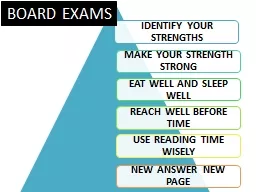
BOARD EXAMS
by lindy-dunigan
TOPO SHEETS. Eastings. Northings. Vertical Lines...
London joint ATM and MA
by test
branch meeting. Task design. 20. th. May . 2017....
Going Dutch: How to Share
by celsa-spraggs
a . Dedicated Distributed Infrastructure . for Co...
The Grid Information System
by crashwillow
Maria . Alandes. . Pradillo. IT-SDC. White Area ...
F ADAlG4 867 IDAHO UNIV MOSCOW LAO OF ANTHROPOLOGY FG 1313
by alis
ARCHAEOLOGICAL SALVAGE OF THE JOSO TRESTLE CONSTRU...
Using topography to estimate flood risk
by trish-goza
Brendan Murphy. CE 397 Flood Forecasting. May 4, ...
Part 1 -- Introduction
by stefany-barnette
Part 2 -- Equipment Needs. Part 3 -- Conceptual F...
Utilization
by pamella-moone
. of GIS in Japan. Hiroyuki KITADA , Yumi SEKINE...
Storm tracking & typing for lightning observations
by pasty-toler
Kristin Calhoun, Don . MacGorman. , Ben Herzog. S...
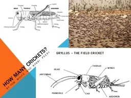
How Many Crickets?
by natalia-silvester
By Tom Wolfe and . bobbi. . Peery. Engage. T...
San Marcos Fire Station Location Analysis
by kittie-lecroy
Andrea Nieto, Bryan Heisinger, Nadine Oliver Matt...
STORE MANAGEMENT
by myesha-ticknor
By. SRK Vuppala. Meaning of Store Management. A s...
Suphot Jitlikhit
by marina-yarberry
Head in, Power System Analysis Section 1 Control ...
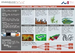
TerraSTREAM: Terrain Processing Pipeline
by danika-pritchard
MADALGO – Center for Massive Data Algorithmics,...
Katherine Stammer
by phoebe-click
Intro to Systems Engineering. A Comparison of Mon...
The complexities of publishing gridded data for the UK
by lindy-dunigan
European Forum for . Geostatistics. Krakow – Oc...
Interconnection Policy Working Group
by briana-ranney
September, 17. th. 2018. Agenda. Con Edison’s ...
Utilization of GIS in Japan
by tawny-fly
Hiroyuki KITADA , Yumi SEKINE. National Statistic...
Load More...